Maps, Facilities and Directions
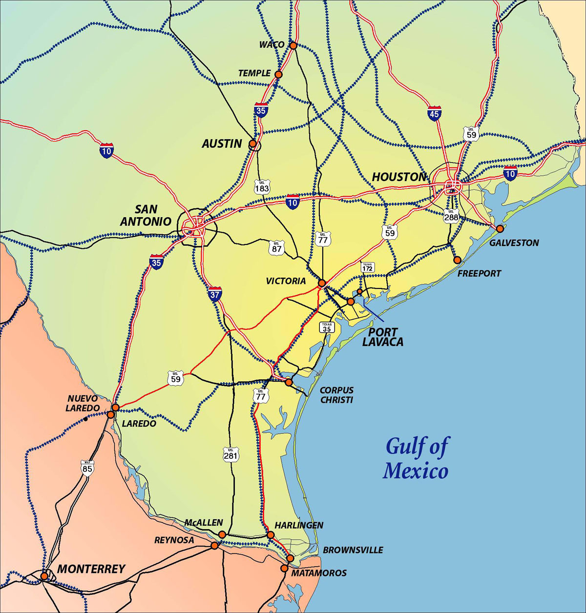
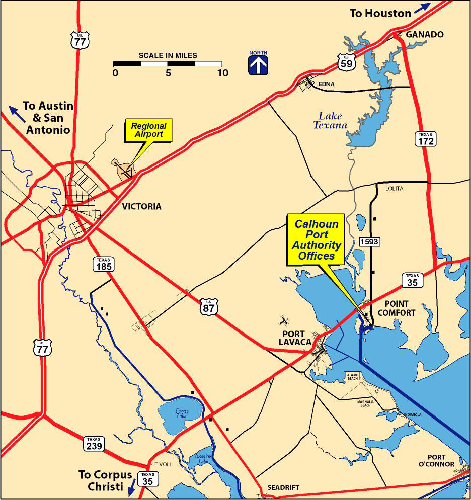
Texas Location
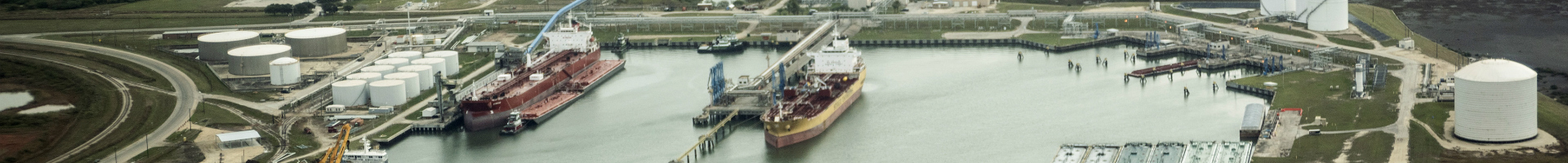
The Calhoun Port Authority is located on the Western Gulf of Mexico near the mid-point of the Texas Coast at 2525 South FM 1593, Point Comfort, TX 77978. The port and related industries are part of a massive Texas chemical, refining and energy delivery complex.
Click on the map for a large version
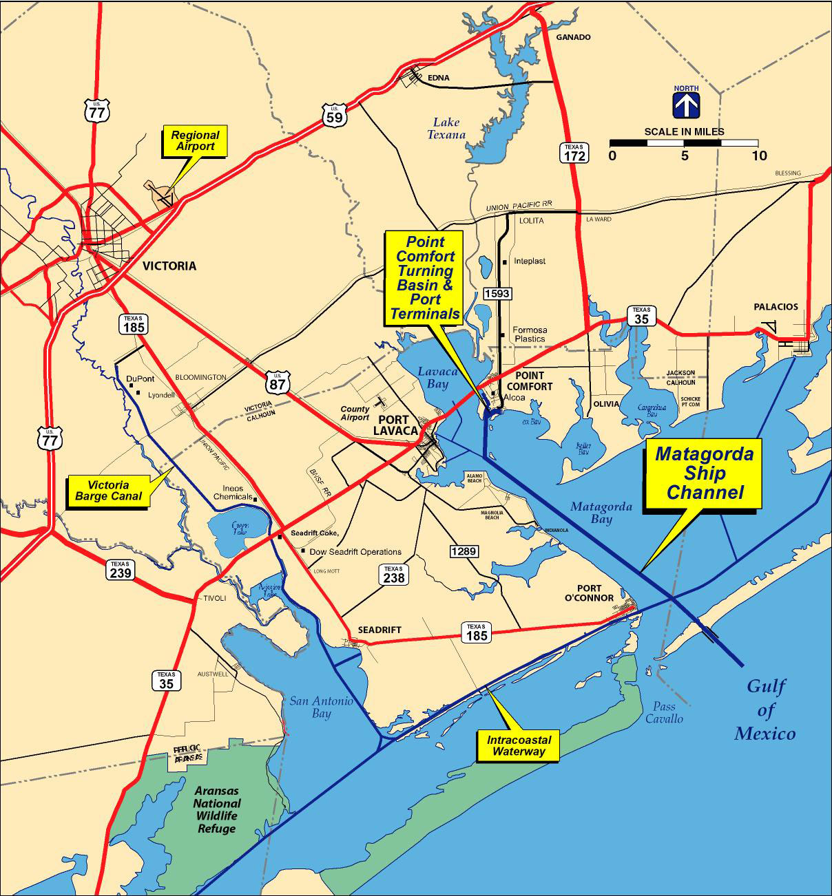
Matagorda Ship Channel
The Matagorda Ship Channel opened to traffic in 1965 and serves hundreds of ships and barges each year. The Gulf Intracoastal Waterway intersects the channel providing barge depth linkage to the nation's inland waterway system.
Click on the map for a large version
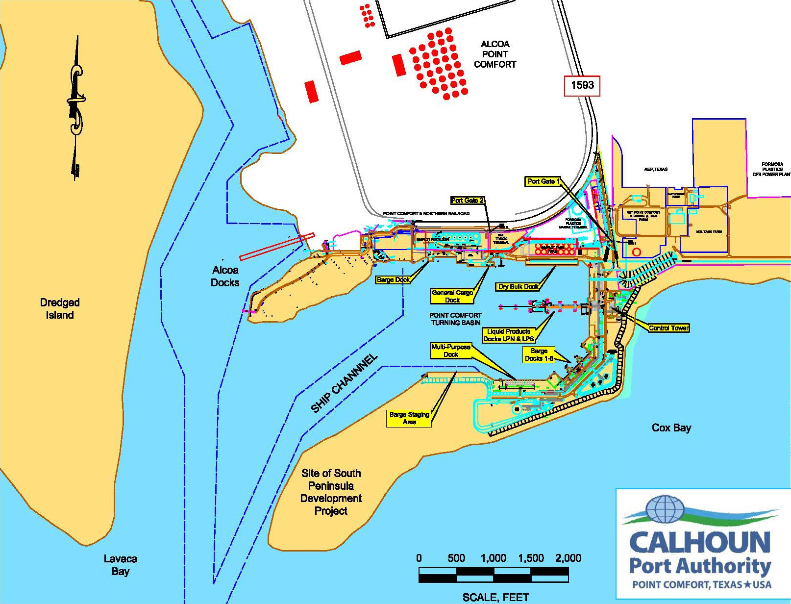
Point Comfort Port Facilities
BARGE FLEETING DOCK
Purpose: Barge fleeting, Bulkhead Length: 900’, Current Water Depth: 14’ MLLW
DRY BULK DOCK
Purpose: Dry bulk, Design Vessel: 750’ LOA, Dock Length: 700’, Current Water Depth: 38’ MLLW, Dock Apron Load Limit: 650 psf uniform, CBP FIRMS No. T259
GENERAL CARGO DOCK
Purpose: break-bulk, liquid & heavy-lift, Design Vessel: 750’ LOA, Dock Length: 250’, Current Water Depth: 38’ MLLW, Dock Apron Load Limit: 600 psf uniform, CBP FIRMS No. T212
MULTI-PURPOSE/HEAVY-LIFT DOCK
Purpose: Liquid cargo & heavy-lift, Design Vessel: 350’ LOA, Dock Length: 400’ at 32' Water Depth MLLW, Dock Apron Load Limit: 1,500 psf uniform, CBP FIRMS No. S081
LIQUID PRODUCT PIER-NORTH
Purpose: Liquid cargo, Design Vessel: Panamax (810’ LOA, 75,000 DWT), Dock Length: N/A, Current Water Depth: 38’ MLLW, Design Water Depth: 47’ MLLW, Dock Apron Load Limit: HS-20 Truck, CBP FIRMS No. V501
LIQUID PRODUCT PIER-SOUTH
Purpose: Liquid cargo, Design Vessel: Panamax (810’ LOA, 75,000 DWT), Dock Length: N/A, Current Water Depth: 38’ MLLW, Design Water Depth: 47’ MLLW, Dock Apron Load Limit: HS-20 Truck, CBP FIRMS No. V502
Click on the map for a large version
Driving Directions to Port Administrative Offices
FROM HOUSTON: Take US 59 south to Ganado; turn left on Texas 172 and travel 23 miles; turn right on Texas 35 and travel 7 miles to traffic light in Point Comfort; turn left on FM 1593 and travel south approximately two miles to the very end of FM 1593. Where the paved road ends, it will fork. Take the left fork that is a limestone road and follow it to its end that will terminate in the parking lot of the Port office building.
FROM VICTORIA: Take US 87 south to Port Lavaca; turn left on Texas 35 and travel 8 miles to Point Comfort; turn right on FM 1593 and travel south approximately two miles to the very end of FM 1593. Where the paved road ends, it will fork. Take the left fork that is a limestone road and follow it to its end that will terminate in the parking lot of the Port office building.
Click on the map for a large version
If you would like to contact the Calhoun Port Authority, or if you are interested in utilizing the world-class Calhoun Port Authority to accommodate your transportation needs, please contact us today.